Verdugo Motorway from Village Avenue (Burbank), Beaudry South, Los Flores Motorway at Sunshine Drive (Glendale)
13 miles
1,900 feet of elevation gain
7 Hours
Olivia Booth, Jennifer and Peter West, Finn West and friends, Corrina Peipon
The city of Los Angeles is bordered to the north by two transverse ranges: the San Gabriels and the Verdugos. The San Gabriel Mountains stretch from the Santa Monica Mountains in the west to the San Bernardinos in the east. The Verdugo Range, tucked into a graceful curve in the footprint of the San Gabriels, floats like an island between the rushing tributaries of the 210 and 5 freeways, to the north and south, respectively. The north end of the range is in Burbank, and the south end is in Glendale, separated from the San Rafael Hills to the southeast by the 2 freeway. At just eight miles in length, the Verdugo Range is the smallest in the group of transverse ranges that divide southern California from the Central Valley. When I learned of the network of trails and fire roads that made it possible to cross the range from end to end, it seemed suddenly very necessary to walk its entirety.
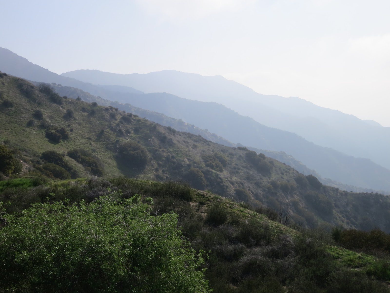
Olivia and I met at the intersection of the Los Flores Motorway with Sunshine Drive in Glendale and took my car up to Village Avenue in Burbank. The Wests were running late, so Olivia and I set out on the single-track trail behind a school at the end of the road. A few switchbacks led us up a steep hillside to a view point marked with a wooden cross and a couple of weather-beaten benches. The sky was overcast with fog making for low visibility, but we could see down into Burbank and the edge of North Hollywood.

From there, a jumble of pathways wound across the hill. We shrugged our shoulders and picked one, figuring that, as long as we were walking uphill, we were probably going the right way. We walked over tumble-down scree through close brambles and desert shrubs until the path widened and revealed a wide ridge delineated by the unsigned Verdugo Motorway. At the junction of the trail and the fire road, a pile of rocks stood sentry, looking due south at Los Angeles and the north side of Griffith Park. We turned to head southeast and ambled down the wide dirt road, around shady bends and into sunny straightaways.

At the junction of Strough Canyon and Verdugo Motorway, we stopped to say hello to a man taking a rest on a bench. He told us of seeing a mountain lion one morning just a few yards from where we were standing. I looked up and saw two people coming down the path into the junction. The Wests had caught up with us, so we continued along the Verdugo Motorway, wondering if Finn and his friends were far behind.

It wasn't long before we encountered huge transmission towers dotting the road at wide intervals, and the hills were high enough here that sparse stands of pine trees covered the hillsides. A spur trail led to a dusty copse with an old bench facing the view of the San Gabriels stretching out to the east. We still hadn't seen Finn and his friends, but the first of a string of phone calls came in asking for confirmation of their choice at a fork in the road. We continued on to the next bench, overlooking the relentless flow of the 210 freeway, and then to the next one, at the junction of Brand Motorway, where we stopped for a quick bite of lunch.
As we readied to head on, a group of five or six walkers came up from the Brand Library trailhead and were happy to have the bench and a bite of Olivia's peanut brittle. Out on the Verdugo Motorway again, we talked and talked as the road traced the curvy spine of the Verdugo Range, dipping down a few yards and then up again until we finally began to descend into a small, rugged canyon and could see large houses nestled into the hillside close by.
A junction was marked with a sign for Beaudry North and Beaudry South. It seemed odd that Beaudry South headed up and back into the hills while Beaudry South led into a residential area that looked like it could be the intersection of Sunshine Drive, where we'd left our cars to shuttle back to the trailhead in Burbank. It wasn't long before our mistake was clear. Luckily, we'd only gone less than a mile out of our way. Walking back up to Beaudry South, we were hot and getting tired. It seemed cruel somehow to be ascending a substantial incline at this point in the walk, but we pressed on, knowing that an apex would come sooner or later to give us some relief at this late stage of a long walk.

We rounded a bend to find an even steeper, longer climb rising ahead of us. Olivia, Jennifer, and I had lost sight of Peter, but we knew we had to keep going; if we stopped, our inertia was in danger of wearing off. Finally, we arrived at the junction of Beaudry South with Los Flores Motorway. After drawing arrows in the sand and piling up a few small cairns to mark the way for Peter and Finn's little band, we began our descent into Glendale. The wide fire road was shaded and offered a sweeping view of the Los Angeles basin, out to Palos Verdes and the endless expanse of the Pacific Ocean. Soon, we heard faraway shouts and bounding footfalls and looked back to see Finn and his friends running down the path, emerging into view like some lost tribespeople who'd been invisibly tracking us all day and finally decided to make themselves known. It wasn't long before they overtook us and slowed their pace, and we all walked the last stretch of the Los Flores Fire Road back down into the paved suburban streets of the Glendale hills.
No comments:
Post a Comment